Latitude (1 of 3) - What is it?
Original Published Date : 2020-05-27
In this first post, we’ll cover what latitude is.
Most of us think of latitude and longitude as grid coordinates on a flat piece of paper. The lines on the map. In fact, that’s how we use them and it’s perfectly fine to think of them that way.
But they are both actually angles.
Latitude is “The angular distance of a place north or south of earth’s equator… usually expressed in degrees and minutes.”
To picture this, consider me – paper-drawn and stumpy legs – standing here at home near Melbourne. I know I’m about ⅓ of the way ‘down’ the Earth; from the Equator to the South Pole. As is the custom we’ll draw the Earth upright, in profile, with north at the top:
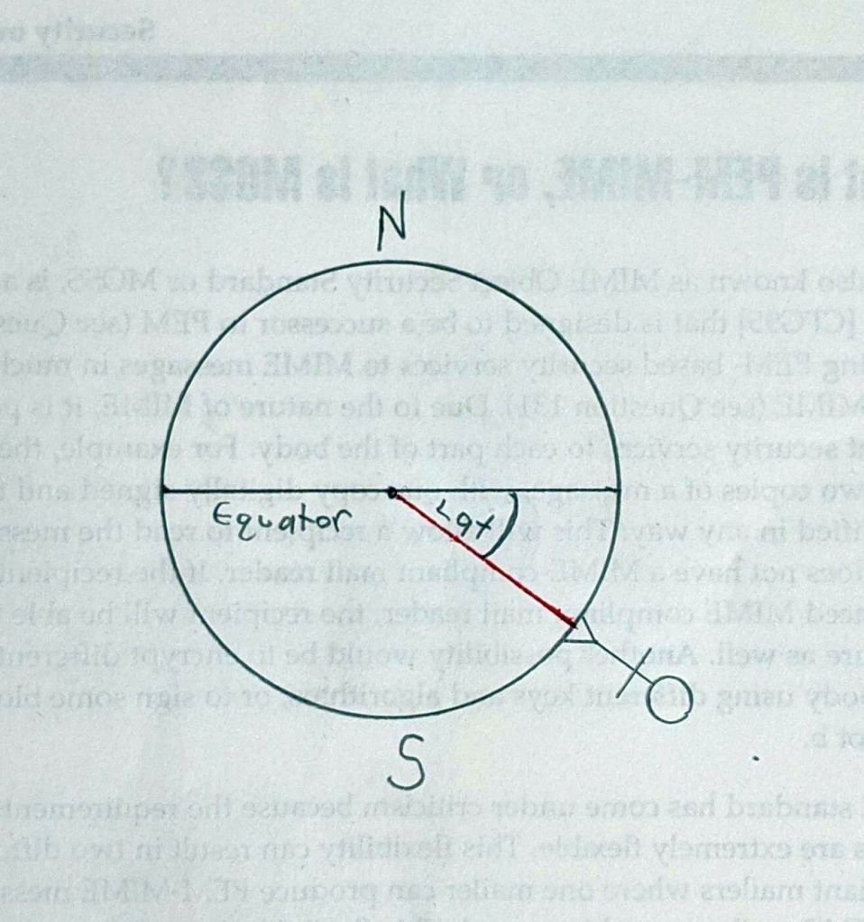 So, that angle – between the equator and the red line – and marked Lat is my latitude. It’s about 40 degrees south. If you think about it, it can only go from 90 degrees at the Poles to 0 degrees at the Equator. London is north of the equator so it’s latitude would be blah degrees north.
In fact, a given latitude is a line parallel to the equator. It ‘slices’ through the Earth as shown by the dashed red line:
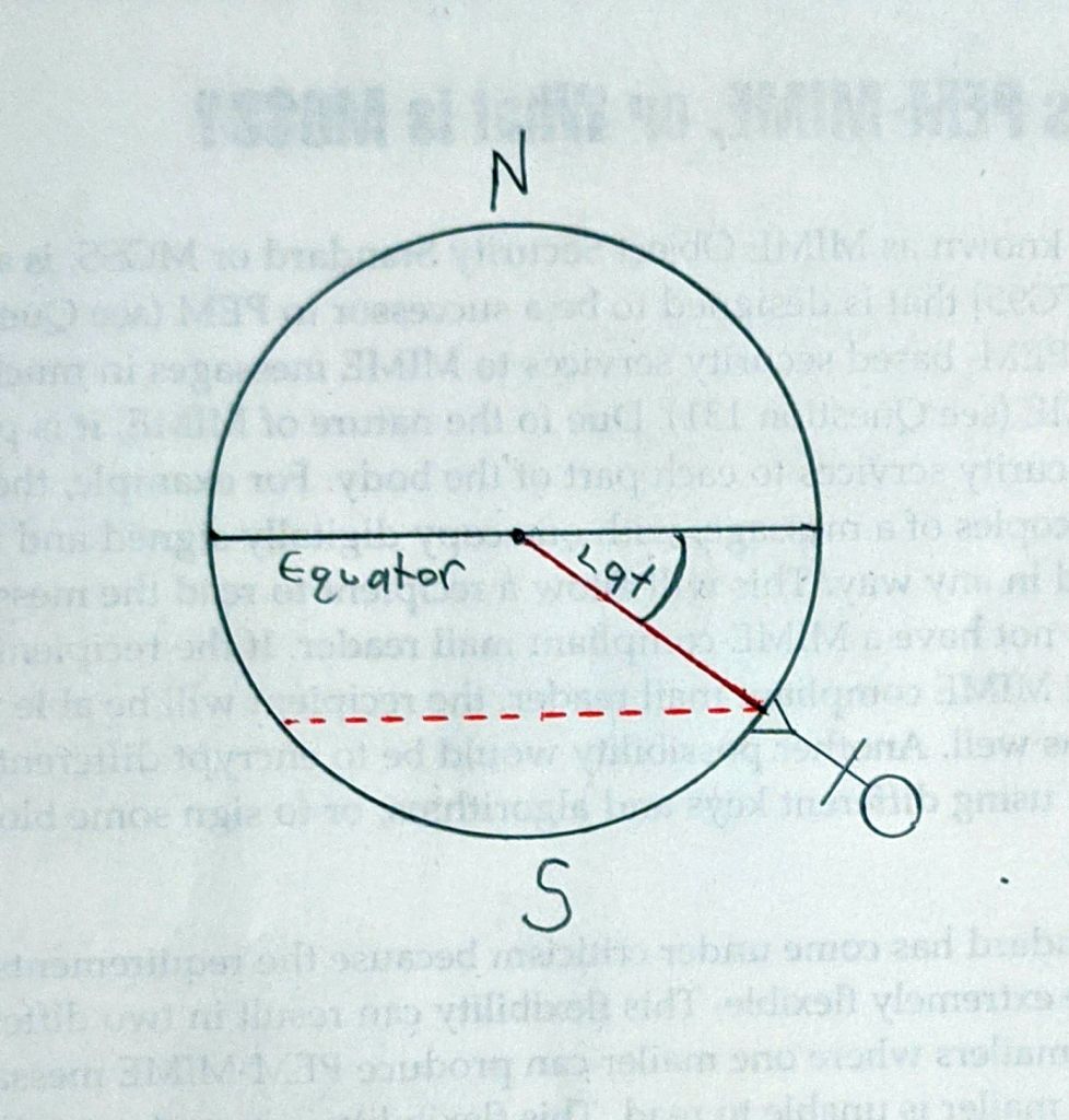 Some parts of the North Island of New Zealand and part of Argentina have the same latitude as me, and so are parallel to me. They’d be on the dashed line.
Sometimes a latitude is just called a parallel:
- The 38th parallel north formed the border between North and South Korea prior to the Korean War.
- The 49th parallel defines much of the international boundary between the USA and Canada.
Degrees?
There’s no getting around it: angles are usually measured in degrees:
- A circle is 360 degrees
- A degree is 60 minutes
- A minute is 60 seconds
To avoid confusion with time, it is useful to say ‘minutes of arc’ or ‘seconds of arc’ with latitude etc.
A latitude of 36 degrees, 48 minutes, 58 seconds is written: 36° 48’ 58”
It can also be useful to convert them to ‘decimal degrees’. Google Earth supports this; as does my old, old calculator! So 41° 30’ 0” could be written as 41.5°
I haven’t forgotten Longitude. It’s more ‘around’ the Earth, specifically: “The angular distance of a place east or west of the meridian at Greenwich, England…usually expressed in degrees and minutes.” From the same web site as Latitude’s defintion.
The last main thing is the aide-mémoire. Latitude lines are horizontal relative to the Earth. So they are flat. And thus flatitude as the memory aid. I only heard this a few months ago and love it.
Behind The Scenes
I can’t draw. Normally I’d use Visio, but currently don’t have it as it’s licensed monthly and I don’t need it. Also, to be honest, it’s sometimes quicker to just get out a bit of scrap paper, my magical new mechanical pencil … and my brilliant secret weapon:
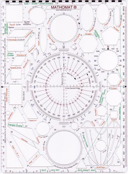
I don’t bother with the scanner, just photograph it/them and upload to Dropbox. Quick crop and brighten on the PC – in the free ‘viewer’ IrfanView – and we’re done.